
Loves Park Previous Residents Sources
A backward address trail combines ownership and occupancy sources. The Winnebago assessor supplies current parcel data and advertises history through 2003. Recorder documentation identifies grantor and grantee index books from 1836 through 1964, but that is book coverage, not a promise that all years are in the free web search. Printed directories and census schedules add household evidence, while maps and aerials help when a street label changes.
| Source | Years It Covers | Where Held | What It Shows |
|---|---|---|---|
| Winnebago assessor | Current and history through 2003 | County assessment search | Owner, taxpayer, PIN, situs, legal description |
| Recorder index books | Documented 1836-1964 series; current web cutoff unstated | Recorder portal, counter, mail, or email | Grantor, grantee, deed and document references |
| Rockford directories | Named run 1869-1960, plus 1857 and 1880 digital books | Rockford Public Library | Listed people, address, trade, residence or boarding marks |
| Federal census | Public schedules through 1950 under the 72-year rule | Library genealogy databases and archives | Household members and enumeration place |
| Historic maps and papers | 1939 aerial; Post Journal 1947-present | WinGIS, NSLD, and RPL | Site context, dated notices, obituaries, maps |
Start with the assessor for a recent Winnebago-side property, then use the deed index. For an address east of Argyle Road, confirm Boone County jurisdiction before ordering records. A pre-1947 question usually calls for Rockford, township, rural-route, or county sources because Loves Park had not yet incorporated under its current city name.
Fix Past Loves Park Addresses
Before looking for past residents, capture four forms of the place: the current street address, Parcel Identification Number or PIN, abbreviated legal description, and county. The Winnebago assessment search accepts PIN, street location, or owner name. Its parcel record distinguishes the situs, which is the property location, from the taxpayer's mailing address. That difference prevents a remote tax address from being treated as an occupant.
Open the parcel in WinGIS Property Search and save the primary or alternate PIN, community, legal description, owner and taxpayer fields, and a map view. The legal description can survive a mailing or street-label change. WinGIS also has a 1939 historic-aerial layer, zoning, flood, ZIP, and linked assessment details. For Boone-side land, use the Boone County Clerk and Recorder and assessment office because a Loves Park mailing name does not shift county custody.
Note: A parcel owner and taxpayer are title or billing clues, not a complete list of people who occupied the address.
Trace Loves Park Past Owners
The Winnebago Recorder keeps deeds, mortgages, liens, plats, surveys, and related land records. A deed chain follows each transfer from the current buyer toward earlier owners. Begin with the present owner and legal description, then identify that owner's purchase deed. The seller on that deed becomes the next person to search as a buyer in the prior transfer.
- Copy the current owner's name, PIN, situs, and legal description from the assessor record.
- Find the purchase deed in the Recorder index and verify that the legal description matches.
- Record the grantor, the person transferring the property, then search that person as a grantee in an earlier deed.
- Repeat the link while logging document type, recording date, book or page, parties, and any image obtained.
- When the online trail stops, ask for the older index book, tract index, counter search, mail search, or email search.
- Grantor and grantee
- The grantor transfers an interest; the grantee receives it.
- Chain of title
- The linked sequence of recorded transfers for the same land.
- Legal description
- The plat, lot, block, section, or metes-and-bounds wording that identifies land more durably than a street line.
Loves Park Previous Residents Records
The Recorder's records search page offers several access channels. Direct Search is free and limited to basic index information without document images. Tapestry is pay-as-you-go; the current county statement gives $8.75 per search plus $1 per printed page. Laredo is the subscription route for frequent searches. The public page does not state a clean starting year for Direct Search.
In person, staff can search at the front desk. After more than five searches, staff show visitors how to use public stations. Copies cost $0.50 per page. The office also takes mail or email searches. A document less than 20 years old costs $10 to search, while one more than 20 years old costs $29; older requests have a five-search maximum. Plats cost $10 per search plus $4 per page. The office does not conduct searches by phone.
The office is at 404 Elm Street, Room 405, Rockford, and lists weekday hours from 8 a.m. to 5 p.m. For a mail request, provide enough detail to isolate the instrument and include a self-addressed stamped envelope or an email address. The office can send a fee total and credit-card link by email and asks for up to two business days. Save the index result even when no image is available, since its parties, date, and recording reference can support a precise copy request.
Insider tip. Omit the comma in a Recorder Party Name search, and take a long chain to the public station when the fifth search is not enough.
Map Past Loves Park Residents
Plats, atlases, and aerial photographs tell a different part of the story. A deed may identify the land but say little about when a structure appeared. The 1939 aerial layer in WinGIS can place the site in an earlier landscape. RPL's house-history guidance points researchers toward atlases, maps, and Rockfordiana files, while NSLD holds plat maps and atlases in its local-history room.
Sanborn fire-insurance coverage and a citywide street-renumbering date were not confirmed in the research. Do not invent either. Bridge an uncertain old number with the legal description, subdivision plat, cross streets, city maps, historic aerials, and consecutive directory years. A permit may add a work date, but the public Citizenserve portal's exact historic coverage was not verified.
Previous Residents Before Incorporation
Loves Park incorporated in 1947, decades after Malcolm Love bought land in the area in 1901. Older records may describe the same area as Rockford, a township, rural Boone or Winnebago County, or a route rather than Loves Park. The Parkside Citizen and later Post Journal help explain the shift into a named city community.
This history changes the search terms. Test a surname with Rockford directories, Boone County histories, township labels, nearby streets, and a family trade. A present ZIP is not a historic jurisdiction. Nor does a current municipal boundary dictate which old archive catalog contains the record. The fixed parcel and its legal description provide the bridge.
The Anderson Archives Room at the Loves Park library holds city directories, plat maps, atlases, photos, oral histories, yearbooks, family files, and organization histories. Access is by appointment, and librarians locate materials. RPL supplies the wider Rockford and Winnebago shelf. This two-library route is stronger than forcing every old address into one city name, especially for years before the bridge, road network, and later annexations shaped the current community.
Myth check. No single online address search reaches the full Loves Park past; books, staff help, maps, and county records remain essential.
Loves Park Previous Residents Permits
A dated permit can help place work at a property between deeds and directory years. Loves Park Community Development handles building, planning, zoning, subdivisions, maps, and code matters. Its building-permit guidance says an inspection request uses the permit number, property address, contact name, phone, and inspection type. Those fields may connect a named contact to a specific project date, but they do not establish every occupant.
Loves Park Citizenserve provides permit application, review status, fee payment, inspection, and property-complaint routes. The research did not confirm the portal's historic start date or full public result fields. If the older permit does not appear, contact Community Development or make a specific city records request rather than treating the missing web result as proof that no work occurred.
Loves Park Previous Household Trail
Owners are only one layer. A city directory can place a listed person at a residence or boarding address, and census schedules can show the household present in a public census year. The regional volumes and their reading rules are detailed on the Loves Park city directory page. Keep an occupant claim separate from title unless a deed or assessor record links the person to ownership.
- Choose a dated directory entry closest to the period under study and transcribe its exact address and abbreviations.
- Check the nearest public census schedule, then compare names, ages, birthplace, family ties, and enumeration place.
- Move forward and backward through nearby directory years to find arrivals, departures, spelling changes, and new street labels.
- Use newspaper notices and obituaries to explain a disappearance, then check an unsealed probate file for an executor or heir trail.
RPL offers obituary and newspaper databases, and NSLD keeps local newspapers, yearbooks, oral histories, photos, and organization files. Cemetery indexes can close a death trail when an official lookup exists or a library or society has indexed the burial. Probate is a circuit-court record, so use the county court route and request only an unsealed file.
For each previous resident, build a dated evidence line: source title, year, page or record number, name as printed, address as printed, and what the source actually proves. A directory may prove only that a person was listed there. A census can show a household on its enumeration date. An obituary can connect relatives and a later place, while probate may identify an executor or heir. Agreement across these sources is more reliable than any single undated name result.
The captured RPL digital local-history collection is one online doorway for past residents, newspaper items, and regional records.
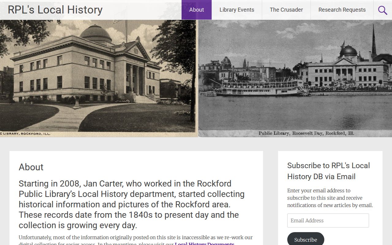
Because the digital collection is being rebuilt and some older material may be unavailable, a failed web search should lead to the document archive, a call, or an in-person library request.
Lawful use. Research previous residents for house history, genealogy, an estate, or personal curiosity. Never use an address trail to stalk, harass, threaten, or track a living person.